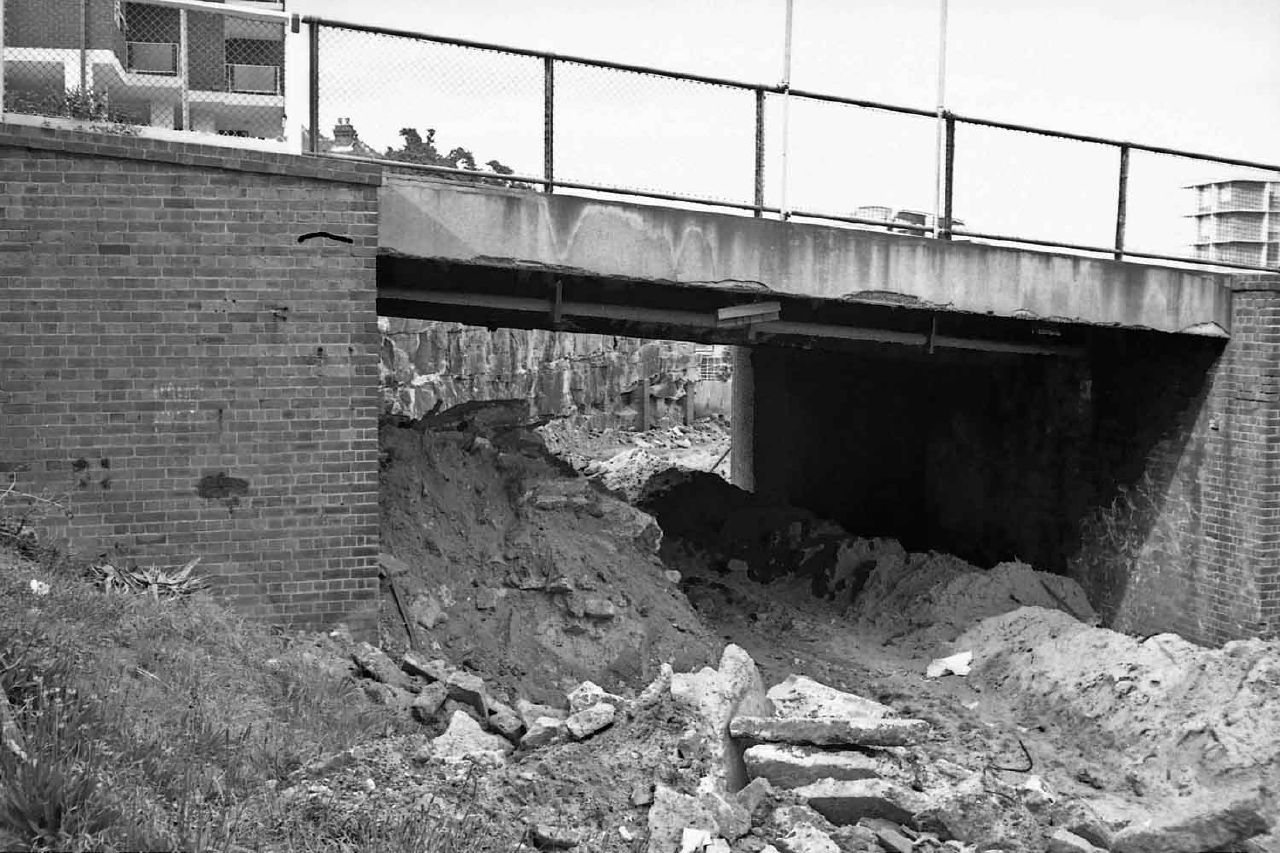
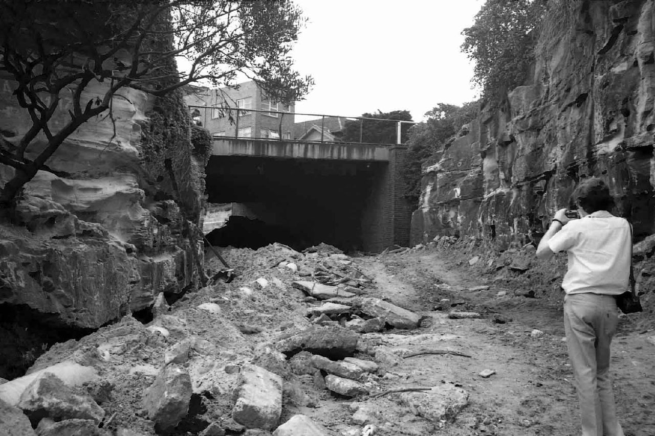
...with cuttings and bridges and curves.... and now we have buses and cars. Oh well. And the tramway reservation? Gone. Filled in. Some of it became park, some sold off to developers. Like a lot of Sydney's reserved track, just gone.
Here are some snaps I took in the mid-70s when the in-filling was taking place...
Shops and services
Jargon-free PC Help
Quality tech products
Bike gear
Books, games, DVDs
Photography tips and tricks
My Most Popular Blogs
Photography tips and tricks
Alfa Romeo Tipo 116
My Opinion
Business, Opinion and Nonsense
Airliners
Business blogging
My Opinion
More Business blogging
Myths and legends
Photography
Photography tips and tricks
History
Sydney history
Bikes and bike racing
Bike racing
Bike racing for beginners
Bike racing 101
Doper's guide to bike racing
Cars - and Alfa Romeos
Alfa Romeo Tipo 116
GTVeloce Style
Showing posts with label reserved track. Show all posts
Showing posts with label reserved track. Show all posts
Monday, December 3, 2012
Saturday, June 26, 2010
The changes wrought to Randwick since 1940
There's so much that's changed here - and it was only 70 years ago. Where do I start?
OK, from the left - South Dowling street just stops at Kensington Golf Links. Today it carries on to the airport. To the left of that, Victoria Park Racecourse - gone. Below, Rosebery Park racecourse - gone, replaced by flats - lot's of 'em. To the right of that is a tramway sand quarry (or whatever you call it!). On the next page is Centennial Park at the top, largely intact but now sadly invaded by sports fields and other "single use" recreations like coffee drinking (not that I don't enjoy a coffee) and car parking.
Below that is Randwick Racecourse with its own tram station. Of course pre-war transport was mostly by foot, bike or tram so the dreaded waste and extravagance of low-cost private cars was still ahead of us.
You'll also spot Randwick Tram Workshop in the middle with a few stretches of reserved track so public transport was not only better but quicker. Wait here for trams: Sydney's trams during the last decade of operation
Click through for more personal research and opinion on Sydney history.
Street directory and associated material, scanned for historical research purposes only. Attribution for street directories to HEC Robinson and Gregory's Maps, now UBD. As I say, it's for historical reference only.
My list of Sydney's race tracks and circuits.
or checkout my list of Sydney and surrounding airstrips and airports.
Victoria Park racecourse - Waterloo according to Wilson's 1926
Nice layout shown here for Victoria Park racecourse, including the tramway on reserved track (probably through a paddock?). Of course it's no more, replaced by a succession of English car makers culminating in the Leyland car plant that built the P76. When the wheels fell off that in the mid-70s it became a Navy supply yard before finally rebirthing as the new suburb of "Green Square", or whatever they call it. To me it's still Victoria Park.
Early aviators such as Defries used Victoria Park racecourse as an airfield (of sorts).
Street directory and associated material, scanned for historical research purposes only. Attribution for street directories to HEC Robinson and Gregory's Maps, now UBD. As I say, it's for historical reference only.
My list of Sydney's race tracks and circuits.
or checkout my list of Sydney and surrounding airstrips and airports.
Labels:
racecourse,
reserved track,
trams,
Victoria Park,
Waterloo
Friday, December 4, 2009
More interesting places to virtually visit
Sydney is awash with tramway remnants, if you care to look. Check these out for starters...
The curves left behind... take the trams away and you just have an oddly-shaped street with a touch of curving mystery at both ends...
Above, Chippo's Meagher Street
Above is Eddy Ave at Central Station, including ramps (later reused for the current 'light rail').
North Sydney station, where the trams ran to the north of and parallel with the railway, running up a ramp (now used as a car park) and across a bridge (over the roadway) to a tram station opposite the Milson's Point railway station. From there they ran on reserved track on the opposite side of the Harbour bridge from the railway, entering a tunnel and terminating at Wynyard.
Above, Randwick Racecourse had it its own tram station, with platforms and an overhead bridge. You can still see some of this structure.
Above and below, Anzac Parade - the busway seen here was once reserved track, and there was a lot of it from here down past the SCG and the Showground and along Alison Road as well. There was reserved track on both sides of Anzac Parade in places, as well as in the central reservation further towards Maroubra.
My list of Sydney's race tracks and circuits.
or checkout my list of Sydney and surrounding airstrips and airports.
Subscribe to:
Posts (Atom)


